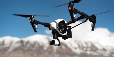
Drone Understanding UAS Maps guidance has gotten complicated with all the outdated regulations and conflicting advice flying around. Here’s what you actually need to know.
Understanding UAS Maps: A Comprehensive Guide
Unmanned Aerial Systems (UAS) have become a crucial technology across various industries. An essential component of managing and operating UAS effectively is the use of specialized maps. These maps provide vital information that assists in navigation, compliance, and mission planning. Here’s a closer look at the elements, significance, and applications of UAS maps.

The Basics of UAS Maps
UAS maps are designed to support the unique requirements of drone operations. They incorporate a range of data layers and are typically more dynamic than traditional maps. Key components include airspace data, no-fly zones, topographical information, and weather conditions. The integration of these elements enables operators to make informed decisions while ensuring safety and regulatory compliance.
Key Elements of UAS Maps
Airspace Information
Understanding controlled and uncontrolled airspace is fundamental for safe UAS operation. Maps indicate the various airspace classes, such as A through G, and special use airspaces like those restricted for military purposes. These maps utilize color-coded systems to differentiate between areas where drones can operate freely and those that require special permissions.
No-Fly Zones and Temporary Flight Restrictions (TFRs)
No-fly zones are areas where drone operation is prohibited. These include airports, military bases, and urban centers. TFRs can also impact UAS operations by imposing temporary restrictions due to events or natural disasters. Timely updates on these zones are critical for planning missions and avoiding legal issues.
Topographical Features
Terrain data helps pilots navigate complex environments by showing elevation changes, bodies of water, and vegetation. This information is crucial for maintaining line-of-sight and avoiding obstacles during flight. It also assists in understanding how ground features might affect signal strength and battery life.
Weather Patterns
Climate considerations are vital for the safe operation of UAS. Maps that include real-time weather data help drone operators avoid adverse conditions like high winds, rain, or extreme temperatures. This data ensures that drones can perform their missions without risking damage or loss.
Ground Control Points (GCPs)
Ground control points are markers used to ensure the accuracy of aerial imagery and measurements. By integrating GCPs, UAS maps enhance the precision of data collection, which is especially important for industries such as agriculture, construction, and surveying.
Applications of UAS Maps
Agricultural Management
UAS maps offer farmers the ability to monitor crop health, assess field conditions, and optimize irrigation strategies. By overlaying multispectral imagery and topographical data, farmers gain insights into productivity and resource management. This technology plays a vital role in reducing waste and improving yield.
Infrastructure Inspection
Drones equipped with UAS maps enhance the efficiency and safety of inspecting infrastructure such as bridges, power lines, and pipelines. High-resolution imagery and accurate location data allow operators to detect issues and prioritize maintenance. This reduces the need for manual inspection, minimizing risk to personnel.
Search and Rescue Operations
In emergency situations, UAS maps provide real-time location data and situational awareness to rescue teams. By evaluating topographical features and access routes, drones can assist in locating missing persons or assessing disaster areas. This rapid information relay can be critical in saving lives.
Environmental Monitoring
Conservationists use UAS maps for wildlife tracking, habitat assessment, and environmental studies. Drones equipped with sensors collect data over large areas without disturbing ecosystems. This approach improves data accuracy and offers a less invasive alternative to traditional monitoring methods.
Urban Planning and Development
UAS maps offer planners a bird’s-eye view of urban areas, aiding in the design and development of infrastructure projects. By providing a detailed layout of roads, buildings, and green spaces, drones help optimize city planning. This capability translates into better resource allocation and sustainable urban growth.
The Role of Technology in UAS Map Development
Advancements in technology have transformed how UAS maps are developed and utilized. The incorporation of geographic information system (GIS) platforms allows for more detailed and customizable mapping solutions. Machine learning algorithms further enhance the data processing capabilities, offering predictive insights for operators.
Remote sensing and satellite imagery are also pivotal in creating expansive, up-to-date maps. These technologies ensure that the geographic data remains relevant, providing global coverage for diverse applications. Moreover, cloud-based solutions enable real-time data sharing and collaboration among users worldwide.
Regulatory Considerations for UAS Maps
Operators must be aware of regulatory frameworks governing UAS use. Compliance with guidelines set by aviation authorities like the Federal Aviation Administration (FAA) or the European Union Aviation Safety Agency (EASA) is mandatory. Regulations often dictate where and how drones can fly, and maps play a key role in illustrating these legal boundaries.
In many regions, drone flights must be pre-approved, especially in controlled airspace. UAS maps offering up-to-date regulatory information streamline this process by providing direct access to airspace authorization requests and real-time updates on restrictions.
Challenges and Opportunities in UAS Mapping
While UAS maps have revolutionized several industries, challenges remain. Maintaining accurate and current data is resource-intensive. Rapid changes in landscape and environmental conditions can quickly make static maps outdated. Collaborating among governmental agencies and private companies is crucial to address these challenges.
Opportunities for growth lie in the integration of artificial intelligence and autonomous technologies. AI can significantly enhance aerial data analysis, transforming raw data into actionable information. This integration could lead to fully automated mapping solutions that further reduce human intervention and errors.
The Future of UAS Mapping
As technology evolves, UAS maps will likely become even more sophisticated. Enhanced sensors and imaging technologies will provide richer data layers. The proliferation of 5G networks promises improved connectivity for real-time data exchanges, making live mapping a reality.
Urban air mobility (UAM) initiatives will increasingly rely on detailed UAS maps for everything from flight path planning to traffic management in the sky. These developments will require ongoing updates to regulatory guidelines to safely integrate UAS into our daily lives.
Overall, UAS maps are indispensable tools that enable the safe and efficient operation of drones across various sectors. As we continue to harness their capabilities, their role in advancing technology and improving industry practices will only grow.
“`


