Elevate Your View: Stunning Drone Photography Tips
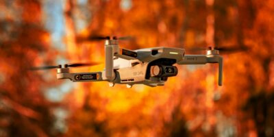
Discover how drone photography revolutionizes capturing stunning aerial shots, making it accessible to hobbyists and professionals alike with advanced and affordable technology.

Discover how drone photography revolutionizes capturing stunning aerial shots, making it accessible to hobbyists and professionals alike with advanced and affordable technology.

Lidar Data Processing involves converting raw Light Detection and Ranging data into usable information. Lidar uses laser light to measure distances, generating 3D Earth surface details.
Explore top drones like the DJI Phantom 4 RTK for excellent land surveying, featuring cutting-edge cameras and sensors for high precision and industry reliability.

Discover local drone inspection services to benefit from advanced drone technology. Drones offer efficient inspections, saving time and reducing human error in various industries.
Learn how to hire a drone pilot near you efficiently. This guide helps businesses, real estate agents, filmmakers, and event planners find local professionals to save time and money.

The aerial imaging market is growing due to tech advances and high demand across sectors, utilizing UAVs, helicopters, and aircraft for diverse applications.

Explore the DJI M30T drone in this detailed overview, covering its standout features, capabilities, and practical uses. Get comprehensive insights to inform your decision.

Digital Surface Models (DSMs) depict elevation including natural and man-made structures. Differing from DTMs, they aid urban planning and various other fields.

The Autel 640T offers versatile high-resolution thermal imaging, making it ideal for professionals and enthusiasts. Discover its unique features and primary functionalities for enhanced work.
Lidar and sonar are remote sensing technologies used to gather environmental data. Each has unique strengths, weaknesses, and applications, making understanding their differences crucial.
Subscribe for Updates
Get the latest articles delivered to your inbox.
We respect your privacy. Unsubscribe anytime.