
Drone Understanding LiDAR Data Proce guidance has gotten complicated with all the outdated regulations and conflicting advice flying around. Here’s what you actually need to know.
Understanding LiDAR Data Processing
LiDAR, which stands for Light Detection and Ranging, is a remote sensing method that uses laser light to measure distances. This technology can create high-resolution maps of the Earth’s surface, making it invaluable in various fields such as archaeology, forestry, and urban planning.

Introduction to LiDAR Data
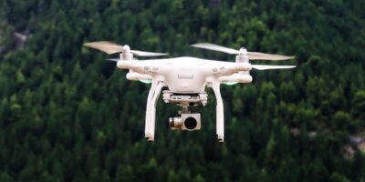
LiDAR data is collected using sensors mounted on platforms such as drones, airplanes, or satellites. These sensors emit laser pulses toward the ground. The pulses bounce back when they hit an object. The time it takes for the pulses to return is recorded, which helps in calculating the distance from the sensor to the object. Multiple pulses are emitted per second, capturing a clear image of the terrain.
Data Collection Methods
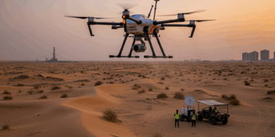
Airborne LiDAR is the most common method. Sensors mounted on aircraft scan wide areas quickly and are ideal for large-scale projects. Terrestrial LiDAR, where sensors are placed on tripods or vehicles, is used for detailed, ground-based surveys. Bathymetric LiDAR uses green laser light to penetrate water and measure underwater terrain.
Raw Data Processing
Data processing starts with the collection of raw data points, known as a point cloud. These points represent the 3D coordinates (X, Y, Z) of objects in the surveyed area. The raw data usually contains millions of points, each representing a precise location in space.
Point Cloud Filtering
The initial point cloud may contain noise due to factors like atmospheric conditions or sensor errors. Filtering techniques are applied to clean the data. Common methods include statistical outlier removal and spatial filtering, which help reduce noise and improve the accuracy of the dataset.
Data Classification
Once filtered, the point cloud data must be classified into different categories. Each point is assigned a label such as ground, vegetation, or buildings. Automated classification algorithms can quickly identify these categories. However, manual classification may be necessary for complex terrains or specific project requirements.
Generating Digital Elevation Models (DEMs)
DEMs represent the Earth’s surface and are created by interpolating the classified ground points. DEMs are used in various applications, including flood modeling, terrain analysis, and infrastructure planning. They provide an accurate representation of the ground, excluding objects like buildings and trees.
Creating Digital Surface Models (DSMs)
DSMs include the tops of buildings, vegetation, and other objects on the Earth’s surface. They are generated using all classified points, not just the ground points. DSMs are crucial for urban planning, architecture, and telecommunications, where the height of objects must be considered.
Extracting Features
Specific features, such as power lines, roads, and individual trees, can be extracted from the point cloud. Feature extraction involves identifying and isolating these elements from the surrounding data. Advanced algorithms and machine learning techniques often aid this process, allowing rapid and precise identification.
Data Validation and Accuracy Assessment
After processing, the data’s accuracy must be verified. Ground truth data, collected through traditional surveying methods, is compared with the LiDAR data. This comparison helps identify any discrepancies and ensures the processed data meets the required accuracy standards.
Data Integration
Processed LiDAR data is often integrated with other geospatial datasets, such as satellite imagery or GIS data. Integration enhances the overall dataset’s utility, providing a more comprehensive understanding of the surveyed area.
Applications of LiDAR Data
- Forestry: LiDAR helps in measuring tree heights, canopy density, and biomass estimation.
- Urban Planning: Detailed maps assist in infrastructure development, zoning, and landscape architecture.
- Archaeology: Discovering ancient structures and mapping archaeological sites become more efficient.
- Disaster Management: Accurate terrain models aid in flood risk assessment and emergency response planning.
- Transportation: Road and railway design benefit from precise elevation data.
Software for LiDAR Data Processing
Numerous software tools facilitate LiDAR data processing, from initial filtering to final visualization. Some popular options include:
- LAStools: A suite of tools for efficient LiDAR processing, including filtering, classification, and feature extraction.
- Fusion: Developed by the U.S. Forest Service, it’s used for LiDAR data analysis and visualization.
- Global Mapper: Offers a range of tools for LiDAR data processing, including terrain analysis and DSM generation.
- ArcGIS: A comprehensive GIS platform that supports extensive LiDAR data integration and analysis.
- CloudCompare: An open-source software that excels in 3D point cloud editing and processing.
Challenges in LiDAR Data Processing
Processing LiDAR data presents several challenges. The volume of data can be enormous, requiring significant computational power and storage capacity. Noise and errors in the data need careful handling to ensure accurate results. The complexity of automated classification and feature extraction demands advanced algorithms and machine learning approaches. Integrating LiDAR data with other datasets can be complex, often requiring specialized software and expertise.
Future Trends in LiDAR Technology
LiDAR technology continues to evolve, with improvements in sensor accuracy and data processing techniques. Advances in machine learning are enhancing automated classification and feature extraction. The integration of LiDAR with other sensing technologies, like hyperspectral imaging, is opening new avenues for research and application. The cost of LiDAR technology is decreasing, making it accessible for a wider range of projects.
Getting Started with LiDAR Data Processing
Begin by selecting a suitable LiDAR sensor and data collection platform, such as a drone or aircraft. Utilize software tools for initial data filtering and noise reduction. Apply classification algorithms to categorize the points in your dataset. Generate DEMs and DSMs to visualize the terrain and surface features. Validate your data with ground truth measurements to ensure accuracy.
Experiment with different tools and techniques to determine what works best for your specific needs. Seek out online tutorials and courses to deepen your understanding of LiDAR data processing. Join forums and communities to exchange knowledge and stay updated on the latest developments in the field.


Stay in the loop
Get the latest light drones updates delivered to your inbox.