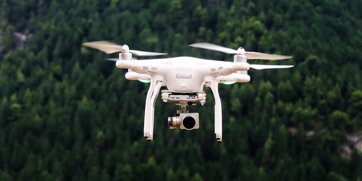
The best utility drone service is not simply the company with the newest aircraft. It is the provider that can legally and safely execute the exact mission, collect fit-for-purpose data, and deliver findings that plug into the utility’s maintenance workflow. Power-line, substation, solar, wind, pipeline, and vegetation inspections require different sensors, flight plans, access controls, and deliverables.
This guide explains how utilities and infrastructure owners should scope a drone project, evaluate providers, and compare proposals. It does not rank vendors based on sponsorship or unverified marketing claims.
What Utility Drone Services Can Inspect
| Asset | Common data products | Important limitations |
|---|---|---|
| Transmission and distribution lines | Visual imagery, thermal data, component inventory, vegetation observations | Long corridors may require BVLOS authority, access coordination, and a defined defect taxonomy |
| Substations | Detailed imagery, thermal anomaly screening, orthomosaics, site models | Energized equipment, electromagnetic environment, security, and nearby airspace require planning |
| Solar arrays | Radiometric thermal imagery, RGB imagery, module-level anomaly maps | Irradiance, wind, temperature, viewing angle, and electrical validation affect interpretation |
| Wind turbines | Blade and tower imagery, defect annotations, repeat-comparison reports | Wind limits, turbine shutdown coordination, surface glare, and consistent stand-off matter |
| Pipelines and rights-of-way | Corridor imagery, erosion and encroachment observations, terrain models | A drone image alone does not establish leak detection or regulatory compliance |
| Vegetation corridors | RGB or multispectral imagery, LiDAR point clouds, clearance measurements | Leaf-on/leaf-off conditions, positional accuracy, and classification requirements must be specified |
Start With the Decision, Not the Drone
Define what decision the inspection must support. “Collect photos of every pole” is not enough. A stronger scope identifies the asset population, defect classes, minimum detectable feature, required location accuracy, severity levels, deliverable format, review responsibility, and deadline.
For example, a maintenance team may need each observation tied to an existing asset ID, GPS position, component type, severity code, annotated image, and recommended follow-up. A provider offering attractive video but no asset-level data structure would not satisfy that need.
FAA Authority to Verify
Most small-drone commercial inspections in the United States operate under 14 CFR Part 107. The remote pilot in command must hold the appropriate certificate, and each aircraft used under Part 107 must be registered. Aircraft that require registration generally must comply with Remote ID unless operating under an applicable exception.
Routine Part 107 authority does not automatically permit every utility mission. The FAA identifies visual-line-of-sight, operations over people or moving vehicles, use of multiple aircraft by one pilot, and certain operating limits as areas that can require specific compliance or a waiver. Airspace authorization is separate from an operational waiver.
Long linear inspections often create a beyond-visual-line-of-sight question. Ask the bidder to identify the exact regulatory basis for the proposed operation and provide the applicable waiver or authorization—not merely say that the company is “FAA approved.” The FAA’s BEYOND program documents real utility-inspection BVLOS approvals, but another organization’s waiver does not automatically transfer to your contractor.
How to Evaluate a Utility Drone Service Provider
1. Relevant asset experience
Ask for projects involving the same asset and defect type. Experience mapping construction acreage does not necessarily demonstrate competence around energized substations, radiometric solar inspections, or transmission corridors. References should confirm the provider’s data was usable, not just that flights occurred.
2. Named personnel and operating authority
Request the remote pilots, certifications, recurrent-training status, aircraft registrations, Remote ID approach, and any waivers or airspace authorizations required for the scope. Confirm who is the remote pilot in command and who can stop the operation.
3. Safety system
A credible proposal should address site hazards, energized equipment, minimum approach distances set by the asset owner, crew communications, takeoff and landing control, weather limits, lost link, flyaway, battery fire, emergency landing, public separation, and incident reporting. Utility safety and switching rules remain controlling; a Part 107 certificate is not an electrical-work qualification.
4. Sensor suitability and calibration
Match the payload to the required evidence. RGB cameras support visual inspection. Radiometric thermal cameras can retain temperature data, while a non-radiometric thermal image may not. LiDAR can produce dense point clouds for clearance and geometry work. Multispectral sensors serve different vegetation or surface-analysis tasks.
Ask for sensor model, lens, ground-sampling distance or stand-off target, calibration method, environmental limits, and sample output. For projects requiring measurement, require a stated accuracy standard and validation method.
5. Data management and cybersecurity
Critical-infrastructure imagery can expose asset locations and configurations. Define encryption, storage region, access control, retention, subcontractor access, cloud-processing terms, incident notification, and secure deletion. Establish who owns raw imagery, processed data, annotations, models, and trained outputs.
6. Deliverable integration
Specify the system that will receive results: GIS, enterprise asset management, work-order software, or a secure portal. Require stable asset identifiers and machine-readable fields where possible. A PDF can summarize findings, but it may be insufficient for thousands of components.
Questions to Put in the RFP
- Which assets, locations, and defect classes are included?
- What smallest feature must be visible or measurable?
- Will flights remain within visual line of sight? If not, what exact authority applies?
- What airspace authorizations, property permissions, or site escorts are required?
- Which aircraft and sensors will be used, and what alternatives are permitted?
- What weather, lighting, loading, or shutdown conditions are required?
- Who reviews and classifies potential defects?
- How will results map to existing asset IDs?
- What are the false-positive review and quality-control processes?
- What data-security, retention, ownership, and deletion terms apply?
- What insurance limits and subcontractor disclosures are required?
- How will incomplete coverage or unusable data be reflown?
Comparing Prices Correctly
Do not compare bids solely by hourly or per-mile flight price. Normalize the scope: mobilization, access planning, pilots and observers, aircraft, sensors, waivers, processing, engineering review, annotation, data hosting, integration, travel, reflight, and reporting.
A low acquisition price can become expensive if utility staff must manually rename files, locate assets, or repeat questionable inspections. Compare cost per accepted asset or usable deliverable when the project permits it, and define acceptance criteria before work starts.
Pilot Project Before Fleet-Scale Deployment
Use a representative pilot containing ordinary assets, known defects, access challenges, and realistic data volumes. Evaluate coverage completeness, image quality, location accuracy, defect agreement, processing time, delivery format, security controls, and the labor required from utility staff.
The pilot should produce measurable acceptance results and changes to the full-scale statement of work. Do not infer a nationwide corridor program from a short marketing demonstration over a single accessible asset.
Red Flags When Hiring
- “FAA approved” with no identified certificate, rule, waiver, or authorization
- Guaranteed defect detection without a defined feature size and validation method
- BVLOS proposed under another organization’s waiver
- Thermal inspection without environmental conditions or radiometric-data requirements
- No written data ownership, security, retention, or deletion terms
- A proprietary dashboard with no export path or asset identifiers
- Claims that drones eliminate all climbing, shutdowns, ground inspection, or engineering review
Related Utility Inspection Resources
- Industrial drone inspection services
- Industrial drone services and workflow planning
- LiDAR drones for aerial scanning
- Commercial drone applications by industry
Frequently Asked Questions
Do utility drone inspections require a Part 107 waiver?
Not automatically. A mission that complies with all applicable Part 107 rules may not need an operational waiver. BVLOS or another operation outside the rule’s standard limits can require one. Airspace authorization is a separate question.
Can drones replace ground inspection?
Sometimes they reduce climbing, exposure, or screening time, but they do not universally replace hands-on testing, engineering judgment, electrical measurements, or regulatory inspections. Define which decisions drone data can support.
What sensor is best for power-line inspection?
There is no universal sensor. The answer depends on the defect: visible damage, thermal anomaly, vegetation clearance, geometry, or another condition. Many programs combine payloads or inspection methods.
What should a utility drone report contain?
At minimum, require asset identity, location, capture date, observation type, severity or disposition, supporting imagery, review status, and any limitations. The exact schema should match the utility’s maintenance system.
Official Regulatory Sources
- FAA Part 107 overview
- FAA Part 107 waivers
- FAA Remote ID requirements
- FAA BEYOND advanced-operations examples
Rules, waivers, and operational approvals change. Verify current FAA requirements and the asset owner’s safety rules for the exact project.


Stay in the loop
Get the latest light drones updates delivered to your inbox.