Drone Best Drones guidance has gotten complicated with all the outdated regulations and conflicting advice flying around. Here’s what you actually need to know.
This article includes affiliate links. We may earn a commission at no extra cost to you.
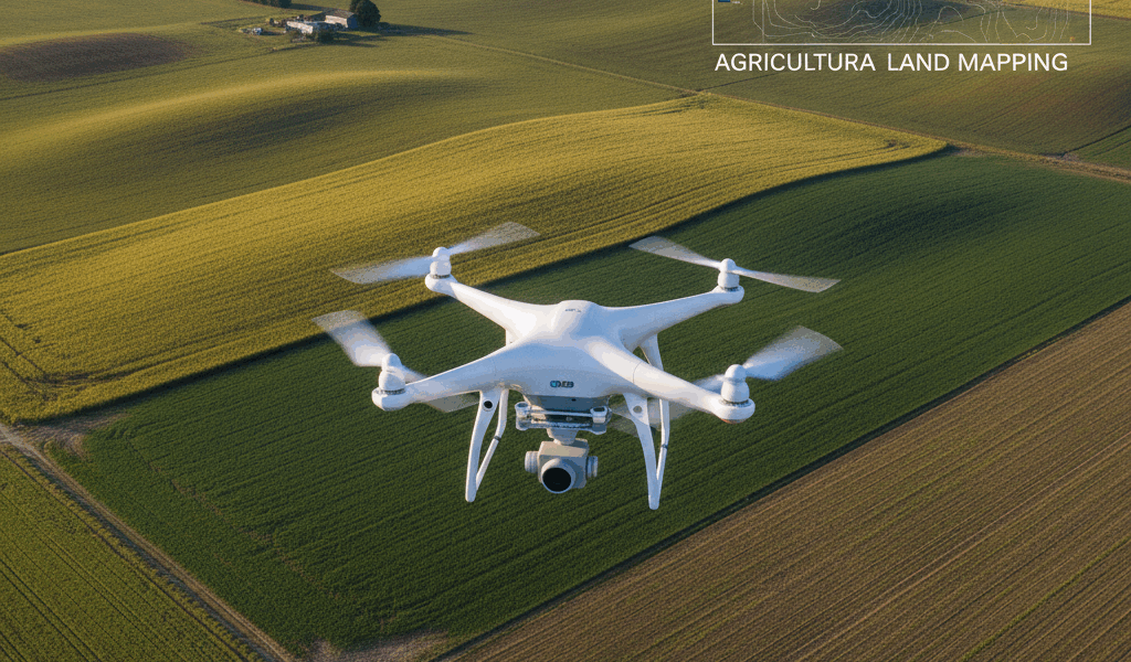
Best Drones for Land Surveying
Probably should have led with this section, honestly. Land surveying has greatly benefited from advancements in drone technology. Drones equipped with state-of-the-art cameras, sensors, and software have revolutionized the industry. Here’s a closer look at some of the best drones currently available for land surveying.
DJI Phantom 4 RTK
The DJI Phantom 4 RTK is renowned for its high precision and reliability. It features a 1-inch 20 MP CMOS sensor. Its RTK module allows for real-time, centimeter-level positioning data. It can capture accurate data quickly, making it ideal for large survey areas.
- 1-inch 20 MP CMOS Sensor
- RTK module for precision
- Intelligent flight modes
- TimeSync feature
The TimeSync feature ensures that the data collected matches the positioning system. Flight time is approximately 30 minutes. The drone has obstacle sensing in five directions. It’s a reliable tool for professionals who need precision and efficiency.
eBee X by senseFly
The eBee X is well-suited for extensive mapping projects. It’s a fixed-wing drone that offers long endurance. It can be equipped with multiple payload options, including those for photogrammetry, multispectral imaging, and 3D mapping.
- Flight time up to 90 minutes
- Variety of payloads
- Survey-grade accuracy
- Easy deployment
It covers up to 500 hectares in a single flight. Its mission planning software is intuitive and user-friendly. The eBee X is a fantastic option for those needing versatility and extended flight times.
Parrot Anafi USA
The Parrot Anafi USA is designed for professional use, including land surveying. It comes with a 32x zoom camera and thermal imaging capabilities. This drone provides detailed and actionable data.
- 32x zoom camera
- Thermal imaging
- Durable and rugged
- Compact and portable
The drone has a flight time of 32 minutes. Its 3-axis gimbal provides stable imagery even in wind. It’s suitable for detailed inspections and surveys of difficult-to-access areas.
DJI Matrice 300 RTK
The DJI Matrice 300 RTK is one of the most advanced drones available for land surveying. It can carry multiple payloads and offers a hybrid mechanical and electronic design. It provides exceptional flight performance and reliability.
- Multiple payload capability
- 55-minute max flight time
- Enhanced AI features for automation
- IP45 rating for weather resistance
This drone can be equipped with the Zenmuse P1 and L1 for photogrammetry and LiDAR surveys. It’s designed for complex and varied surveying tasks. The Matrice 300 RTK is suitable for high-end, intricate surveying projects.
WingtraOne
The WingtraOne is a vertical takeoff and landing (VTOL) drone. It merges the flexibility of multirotors with the efficiency of fixed-wing drones. It’s capable of covering large areas with high-resolution imagery.
- VTOL technology
- Up to 59-minute flight time
- High-resolution camera systems
- Survey-grade PPK (Post-Processed Kinematic) accuracy
The WingtraOne is easy to operate and deploy. It can achieve down to 1 cm absolute accuracy. This drone is excellent for various survey applications where both precision and efficiency are required.
Delair UX11
The Delair UX11 is another top-tier option for land surveying. This fixed-wing drone is designed for precision and flexibility. It incorporates PPK capability and industry-grade sensors.
- Long-endurance flights
- PPK for high accuracy
- Scalable and flexible payloads
- Optimized for geospatial data
Its flight time can reach up to 59 minutes. It offers fully autonomous flight and easy-to-use mission planning software. The Delair UX11 delivers consistent and accurate results, making it an invaluable tool for surveyors.
Autel Evo II Dual 640T
The Autel Evo II Dual 640T brings innovation with its dual-sensor payload. It includes an 8K video camera and a FLIR thermal sensor. This drone is great for inspections and surveys where thermal imaging is beneficial.
- Dual-sensor payload
- 40-minute flight time
- 8K ultra HD video
- Adjustable parameters for thermal and visual data
The Evo II Dual 640T works well for detailed analyses. Its features allow surveyors to capture high-resolution visuals and thermal data simultaneously. It’s a robust solution for comprehensive land surveying.
Yuneec H520E
The Yuneec H520E is a versatile and reliable hexacopter. It’s built for commercial applications and excels in various aerial tasks including land surveying.
- Interchangeable cameras
- 45-minute flight time
- Precision control and stability
- Weather-resistant design
The H520E can carry different sensor payloads, including thermal and RGB cameras. Its data integration software supports multiple formats for processing. This drone is ideal for surveying tasks that require versatility and precise data collection.
Conclusion
In the fast-paced world of land surveying, choosing the right drone is crucial. Factors like flight time, payload capacity, sensor quality, and accuracy make a significant difference. The options listed above represent the best in the market, catering to a variety of needs and preferences. These drones are transforming the way surveyors collect and analyze data, offering innovative solutions for modern challenges.


Stay in the loop
Get the latest light drones updates delivered to your inbox.